Tuesday, May 31, we left
Fairview to make our way west. Our
ultimate destination was Anacortes, WA, but we weren’t due there until July
8. We’ve planned many stops along the
way. Our intermediate destination was to
be in Visalia, CA, on June 15, and we’ve allowed plenty of time to get
there. Our hope was that we would find
an interesting place to stop and explore for a few days before travelling on to
the next interesting stop.
Following friend Chuck’s advice (who has driven between
California and Illinois many times), we decided to take US 54 and US 56 to I-25
in New Mexico. Certainly we could have
found a faster route, but we were excited to “take the road less travelled”.

Our first night’s stop was in Linn Creek, Missouri, in
the Lake of the Ozarks country. We
realized that we had never explored this area!
Jan remembered vacationing there with her parents and brothers about 60
years ago, but that didn’t count. We
were close to Bagnall Dam and were off to explore. Lake of the Ozarks was one of those Depression era
success stories. Construction had begun
four months before the Stock Market crash of 1929, so this area of central
Missouri had plenty of jobs during the 30’s.
The impoundment of the Osage River eventually created a
shoreline longer than that of California.
One of those quirky facts that we liked to uncover: among others, backwaters extended up into the
Pomme De Terre River, named by the Lewis and Clark expedition. The name means “Potato River”. Wild potatoes?? Even more interesting, the indigenous Osage
people called this river “River of Big Bones”, for the mastodon bones they
found along its banks!

It was quite evident to us that this area of central
Missouri
relied heavily on the tourist
dollar. We saw lots of condominiums
sitting at the water’s edge next to a marina full of speedboats, restaurants of
all sorts, and, of course, a microbrewery or two. Horseshoe Bend Brewing Co. wasn’t our
favorite, but we knew we cannot always hit a homerun!
Our route on US 54 through Missouri and into Kansas was
beautiful. Off the interstate, we
travelled through every little town enterprising enough to entice US-54
through the middle of their
downtown businesses. We saw beautiful
old courthouses sitting in town squares, storefronts that had seen better
times, and homes built 100 years ago.
This wasn’t a fast way to travel, but so interesting. As I’ve said before, for us the trip is about
the journey, not the destination.

Eventually, US 54 took us to Wichita, KS. We had passed through here last fall and
resolved to return and explore…and so we did.
We parked Abe at the Air Capital RV Park and drove downtown to a likely
looking brewery - River City Brewing Company.
We found great beer and yummy food, in the Old Town part of
Wichita.
The primary reason we wanted to explore this area was
because of Wichita’s aviation history.
According to Wikipedia: In 1917, Clyde Cessna built his Cessna Comet in Wichita, the first aircraft built in
the city. In 1920, two local oilmen invited Chicago aircraft builder Matty Laird to
manufacture his designs in Wichita, leading to the formation of the Swallow Airplane Company. Two early Swallow employees, Lloyd Stearman and Walter Beech, went on to found two prominent
Wichita-based companies, Stearman Aircraft in 1926 and Beechcraft in 1932, respectively. Cessna, meanwhile, started his own company in Wichita in 1927. The city became such a center of the industry
that the Aeronautical Chamber of Commerce dubbed it
the "Air Capital of the World" in 1929. (Were you wondering about the name of our RV
park? That’s where it came from!)
We had great hopes for the Wichita Air Museum, housed at
the airport in the 30’s Art Deco terminal.
Imagine our disappointment when we discovered it was only open on the
weekend! Rats. We were due to leave Wichita on Saturday
morning, June 4. Not to worry,
though! Other places to explore awaited!

We drove downtown to see the Keeper of the Plains statue
at the confluence of the Arkansas and Little Arkansas Rivers and enjoy a walk
along the water. The statue was erected
in 1974 and stood 43’ tall.

There were several museums along the river as
well as a beautiful view of downtown Wichita.

Our next stop was Wichita’s botanical gardens and a
delightful stroll the through beautiful displays. I was particularly proud of this photo of a
bee on a cone flower, but I could bore you with many more!
Friday, June 3, following up on recommendations from
another friend, Dave Carpenter, we drove to Hutchinson “Hutch”, KS. Dave suggested we see two things: Stratica salt mine and the Cosmosphere
museum. What good advice!

We were surprised to learn of this huge salt deposit in
the middle of Kansas…far from any ocean.
The Stratica web site was a wealth of information: The Hutchinson
Salt Member of the Permian Wellington Formation was formed about 275 million
years ago when the Permian Sea dried up. One of the largest in the world, the
extent of this bedded salt deposit is 27,000 square miles in central and
south-central Kansas and is marginal to Permian Basin salt deposits in Oklahoma,
the Texas Panhandle, and southeastern New Mexico that cover 100,000 square
miles. The purest portion of the salt vein at this location is 650 feet
underground and is still mined here today. Strataca has access to about 300,000
square feet of mined out area. We also learned that this huge salt deposit was
discovered in 1887 by a man who was looking for oil on his property and salt
mining had occurred in some fashion ever since.
If all of the mine tunnels and chambers were lined up end to end, the chamber
would be 150 miles long.

Of course, we couldn’t pass this tour up so donning hard
hats, away we went. The tour included a
“salt railroad car” ride through the tunnels and rooms and a small museum
display, all below ground, surrounded by walls of salt. During the tour we saw many rusty remnants of
old mining operations. (I should mention
that this part of the mine was worked in the 40’s and 50’s. Although salt is still mined here, the active
mining was far from where we were allowed to explore). Nothing that was brought into the mine was
returned to the surface and everything was brought down in a 4’ X 5’
elevator!
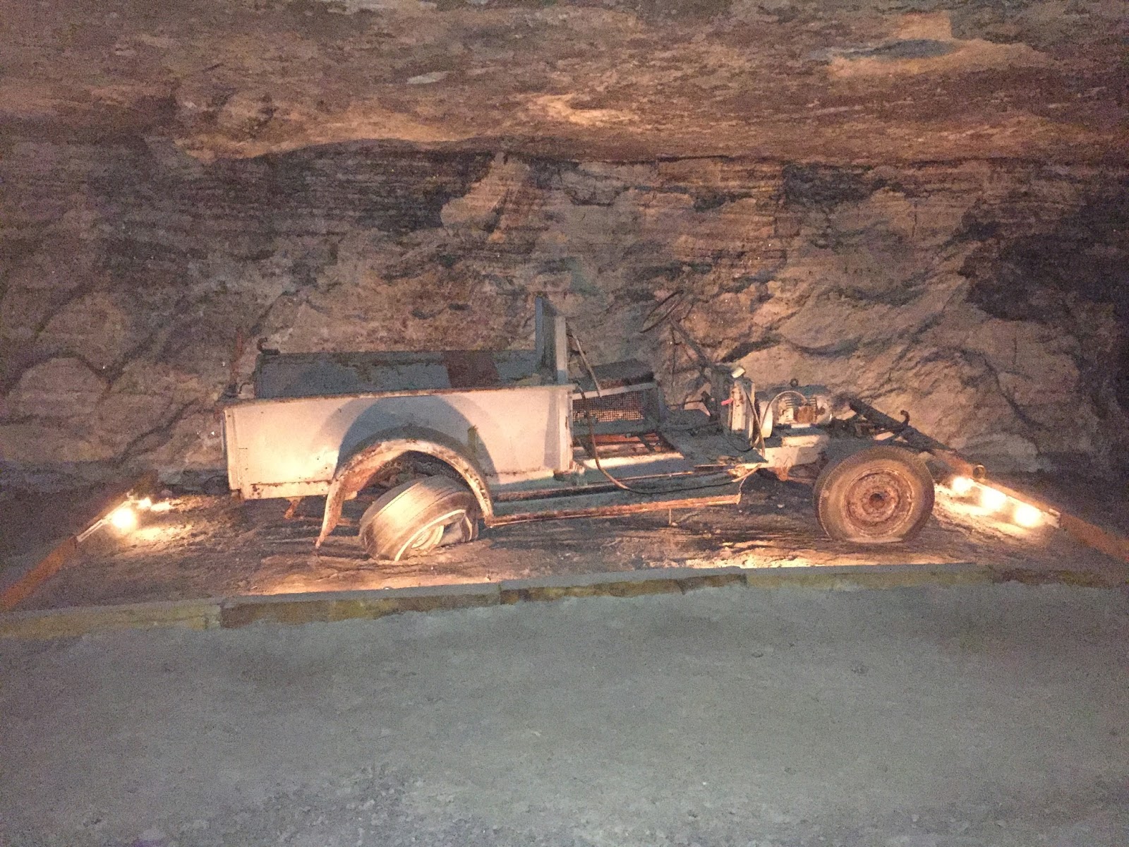
This old truck was dismantled then reassembled in the mine.

A document storage company had purchased a large portion
of the inactive mine. Old medical
records, state documents, and even archived movies and costumes were stored
here. This area reminded me of that last
scene in “Raiders of the Lost Ark” where the Ark of the Covenant was stored in
a huge warehouse. I suspected there were
some rather interesting things in some of these boxes.

What were the other 35?

Our second stop in Hutchinson was the Cosmosphere, a
superbly done museum of space flight. It
was rather anticlimactic after the salt mine and delivered much the same
information as the museum we had been to in New Mexico. Jerry did manager to get his photo taken with
a couple of astronauts, though.

Saturday, June 4, we hit the road
again, to the very SW corner of Kansas and the little town of Elkhart, KS, on
US 56. I was not very optimistic about
this stop, but since it was just for overnight we really just needed a place to
park. Prairie RV Park turned out to be
behind a carwash! We did have a patch of
grass but that was all. We did, however
have 50 amp power and only paid $20 to stay…not bad!

Acting on our belief that there was
always something new to see we went exploring.
We knew that we were on the edge of the Cimarron National
Grasslands. We soon discovered that the
Santa Fe trail passed through this area and that Point of Rocks was a famous
landmark that marked the route.

We followed remnants of the Santa Fe
trail as we travelled through the panhandle of Oklahoma and into New
Mexico. This butte, called Wagon Mound,
just outside of town of the same name.
Using our trusty “Roadside Geology of New Mexico” we learned that this
butte was the result of two separate lava flows occurring in the past couple of
million years. This landmark was used by
the travellers on the Santa Fe trail as a guidepost for the route to Santa Fe…6
days away! We made it to Santa Fe from
Elkhart, KS, in about 5 hours! Good not
to travel in a covered wagon.

We settled in to Santa Fe Skies RV
Park for three days to explore this area too.
We had not been to Santa Fe before and were ready to learn. Since we arrived on Sunday, June 6, there
wasn’t much going on, so we found the Railyard area of Santa Fe and another
microbrewery - Second Street Brewing Company.

Have you ever been on a long
vacation and simply reached your saturation of learning/seeing/doing new
things? That’s how we felt about Santa
Fe on Monday morning, so we headed for the hills…literally. We drove into the Jemez Mountains, about an
hour NW of Santa Fe to see Bandalier National Monument.

From
Wikipedia:
Bandelier National Monument is a
33,677-acre United States National Monument in New Mexico preserving the homes and territory of the Ancestral Puebloans of a later era in the Southwest. Most of the pueblo structures date to
two eras, in total from 1150 to 1600 CE. The Monument is 50 square miles of the Pajarito Plateau, on the slopes of the Jemez Volcanic field in the Jemez Mountains.
The ruins of the Puebloan city were
located along Frijoles River canyon, with some of the structures on the floor
of the valley and some of the rooms along the walls of the canyon. These Indians were hunter-gathers with
rudimentary farming skills, but had a large trade route extending into
Mexico. Their life span was about 35
years and they were small in stature…men 5’6” and the women 5’. The rooms of their dwellings reflected their
size.

We were not far from Los Alamos and
thought surely there would be a great museum there, but as luck would have it,
the building was undergoing extensive remodelling and did not get good
reviews So, we did some grocery shopping
and found a spot for a beer and dinner.
Pajarito Brewpub and Grille had some of the best calamari we’d had
outside of Monterey, CA. Yum!

All three late afternoons at Santa
Fe Skies RV park we had clouds, wind and the threat of rain. Too early for the Southwest’s monsoon season,
but that was what it felt like. The
first evening we were there, the counties to the south of us had tornado and
hail warnings. Yikes! We had wind and showers on the second evening
for a little while, which gave us a lovely double rainbow. Our RV park sat on a ridge overlooking the
valley and we had spectacular views of the clouds as they boiled up to the
south of us.
On Tuesday, June 7, we made it to
the old part of Santa Fe to visit the historical museum and the Palace of the
Governors. Santa Fe has been the capital
city for five different entities…Spain, France, the Confederacy, Texas, and, of
course the US. Lots of history here!
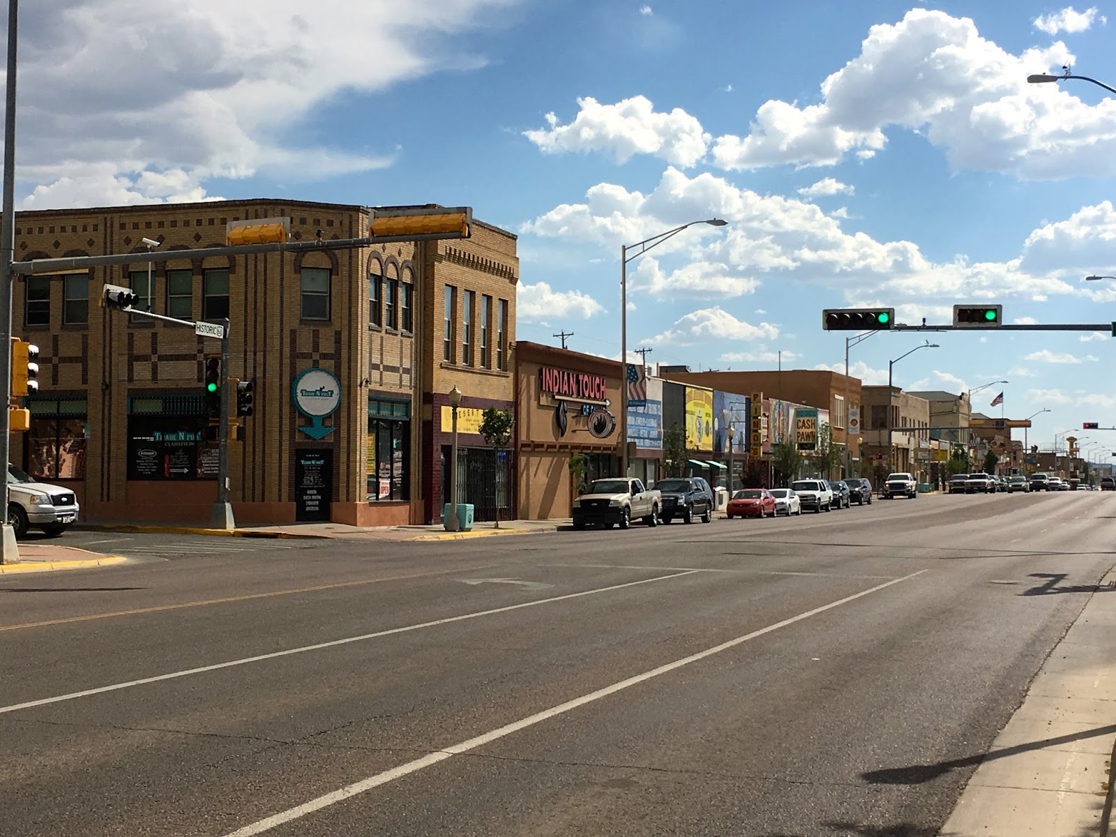
We arrived in Gallup, NM, on Wednesday, June 8, and
planned a two-day stay. We drove to see
the downtown and found it to be full of old buildings, pawnshops, and Indian
merchandise stores. Gallup was in the
middle of a Navajo Reservation and was quite proud of its Indian heritage.

Native Americans from Arizona and New Mexico were the
Navajo Code Talkers during World War II.
These young Navajo men were Marines who used their knowledge of the
Navajo language to transmit secret military information in the Pacific
theater. Their “code” was never broken
and not one message was lost or incorrectly transmitted. After the war the young men who returned home
became community leaders and change agents for better lives for the Navajo
people. Very impressive!

During the 30’s and 40’s Gallup was a popular location
for filming Westerns. El Rancho Hotel
was where the film crews and actors stayed while making movies. In fact, over 150 “Hollywood Stars” stayed
here, including Jimmy Stewart, Katharine Hepburn, and John Wayne, among many
others. The hotel is on the National
Register of Historic Places and was still in operation. We wandered the hotel hallways and saw a star’s
name above every door, but never found the room belonging to John Wayne…and you
know we looked!
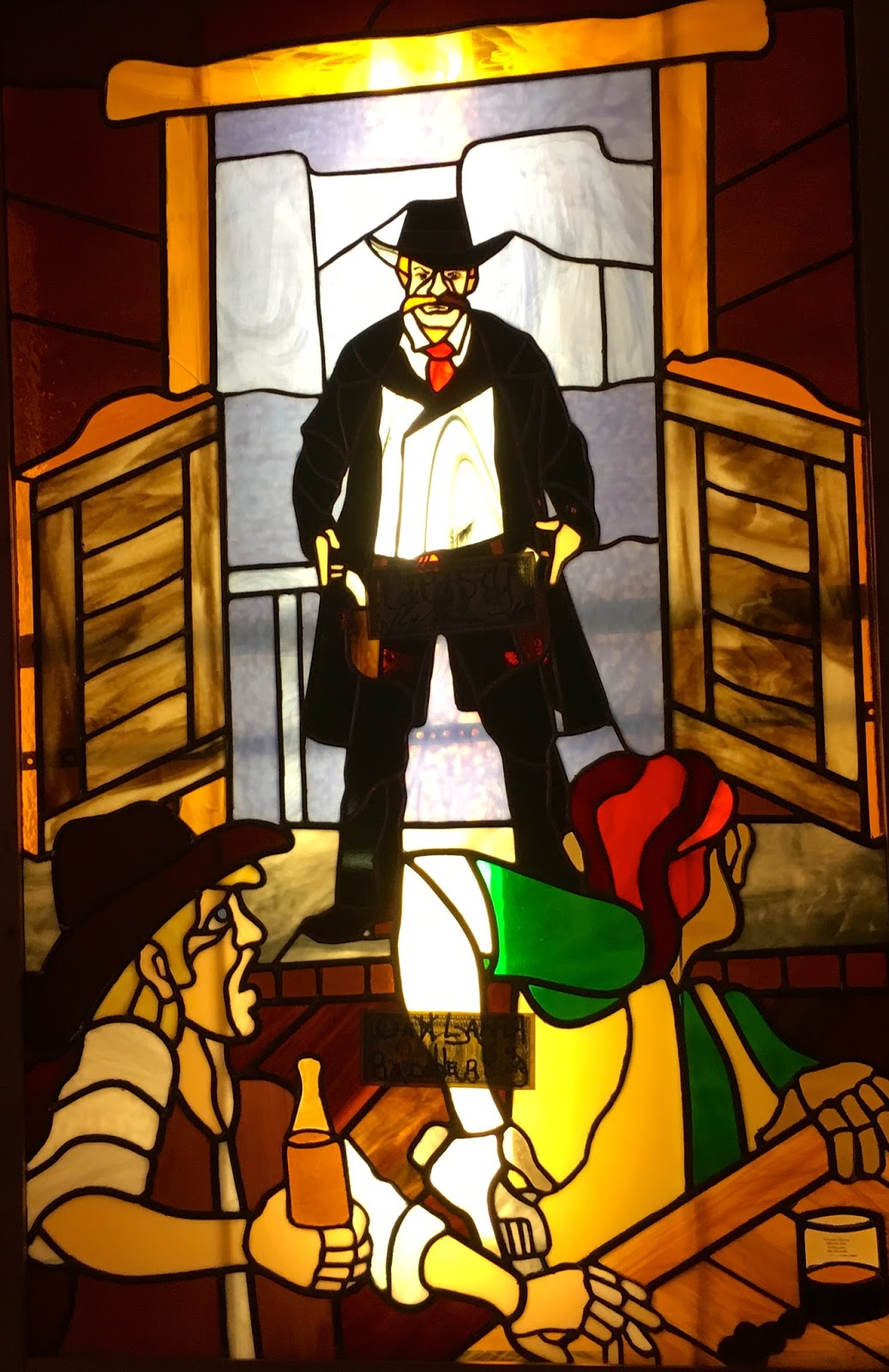
The 49er Lounge, the El Rancho Hotel’s bar, was an
interesting spot. Probably because
Gallup was on Route 66, this bar had lots of business. The members of a vintage car club were
“wetting their whistles” the afternoon we were there. The picture above shows one of the stained
glass windows in the bar…the best of several.
Lots of patrons from all over the world had tacked dollar bills to the
walls and ceiling…but not us.

Friday, June 10, we were on the road, headed west once
again, with Flagstaff, AZ, in our sites.
Although we had driven through here several times in the last 30 years,
we had never stopped to explore. We
thought three days here ought to do it!
Greer’s Pine Shadows RV Park was our home away from home and an
interesting spot. We managed to get Abe
leveled ok, but no way could we use our camping chairs without putting blocks
under the front legs, so we wouldn’t fall out of them!

Our first touristy destination was north on US 89 and
Sunset Crater Volcano National Monument.
This whole area had experienced a huge amount of volcano activity. As recently as 10,000 years ago the volcano
sent ash over 800 square miles and ejected miles and miles of lava. Because this area was so dry and at an
elevation of at least 7,000 feet, the weathering of the lava flows had been
minimal.

At the time of Sunset Volcano’s eruption, there were
ancient Pueblo people living in the area.
No doubt many died, but the ruins of many of their Pueblos remain and
were a part of Wupatki National Monument. We stopped at “the Citadel”, ruins on top of a small
mesa, which overlooked a sinkhole. What
an interesting spot. Jerry did a great
job of composing this photo. In the
background were the San Francisco peaks (more old volcanoes), the sinkhole, the
Citadel ruins, me (of course!) and a rain cloud with virga (rain that didn’t hit the ground).
By late afternoon we had absorbed all the information of
the area that our brains had room for, so it was off to old downtown Flagstaff
and a beer at Flagstaff Brewing Company.
The whole southwest seemed to be infected with the notion that beer
should be “hoppy”…not our favorite! So,
after one beer at this spot we went across the street to Lumberjack Brewing
Company and found brews to our liking.
Even better, we sat around the outside fire pit and visited with three
young (our kids’ ages) couples from Phoenix that had come north to escape the
heat. Delightful, chance meeting and lively conversation with
folks we’ll never see again!

Saturday morning we decided to drive to Sedona by way of
Oak Creek Canyon. This 12-mile long
route between was one of the more spectacular drives to be had. Travelling through this amazing area prodded
the amateur geologist in both of us and we learned that about 8 million years
ago, the Oak Creek Fault became active.
The modern Oak Creek Canyon developed along the fault zone as Oak Creek
eroded the area. The spectacularly eroded
walls of the canyon are buff to white and red Permian sandstones. The youngest rocks were a series of basalt
lava flows, the youngest of which is an estimated 6 million years old.

Jerry had been here with his buddy Chuck 25 years ago or
so and knew to drive to the top of the mesa where the airport was located. What spectacular views!!! We discovered a path to the “Sedona Overlook”
that led from the airport parking lot and soon found ourselves on top of this
little knob. From here we had more
spectacular views to the northeast.
These red sandstone mesas were mesas were beyond description

We chose an alternate trail back to the airport parking lot, called the “airport loop”. We were rather naïvely thought that this
would be a shortcut back to the truck…in 95o heat and no water! About a mile into the route we turned back,
and later learned that the loop was 3.3 miles.
Whew!!

We did get to see more
spectacular scenery, though!

We continued to drive southeast out of Sedona along AZ
179, the Red Rock Trail, and eventually connected with I-17 to return to
Flagstaff. Along the way we found the
Full Moon Saloon and re-hydrated ourselves.
We had the place to ourselves and had a lively conversation with Jordan,
the bartender, who reminded us of daughter, Joy!

Sunday morning we were off toe church at Living Christ
Lutheran Church, about ¼ mile down the road.
This congregation, like so many others we have visited is shrinking and
is in the call process for a pastor who will assist them in growth through deliberate
community outreach. The folks we met
were warm welcoming, and we wished them well in their endeavors!

Sunday afternoon, June 12, we drove to Lowell
Observatory, located on a mesa on the west side of Flagstaff. Percival Lowell, a wealthy Bostonian,
established the observatory in the 1890’s to search and record the canals of
Mars. (Of course, the notion of Martian
canals has since been disproved). It was
here in 1930 that Clyde Tombaugh identified the ninth planet, Pluto. Pluto has been demoted from
planet status to that of a dwarf planet, but that fact was barely touched upon
during our tour.

The Clark telescope was built in 1896 and
housed in a dome built by two local bicycle repairmen. The telescope was used to identify the
expanding nature of the universe…another significant discovery. Lowell Observatory has been busy!

Monday we left the cool temperatures of Flagstaff and
continued west on I-40 to Needles, CA.
What a shock! Our weather station
said the outside temp was 101 but it was a dry heat. Needles expected to have
120o temps by the weekend. We
didn’t linger!

Tuesday, June 14, (today) we parked just east of
Bakersfield, CA and will make it to Visalia tomorrow, June 15. As we drove across the southern end of the
Mojave Desert, we were surprised to see the hillsides showed a hint of
green. Usually by mid-June the hills are
a golden brown. We saw lots of LONNNGGG
trains as we travelled through Arizona and this part of California.

Our final descent into the San Joaquin Valley, our home
for more than 30 years, reminded us of the importance of agriculture all
throughout the central valley. In fact,
the RV park where we stopped is in an old orange grove on the east side of
Bakersfield.
We will be in California visiting family and friends for
several weeks, so there will be more stories to come!
so enjoyable to see the southwest again, and from the perspective of different eyes than our own...Pat Carrie Smith
ReplyDelete